[GUEST ACCESS MODE: Data is scrambled or limited to provide examples. Make requests using your API key to unlock full data. Check https://lunarcrush.ai/auth for authentication information.]  NWS Green Bay [@NWSGreenBay](/creator/twitter/NWSGreenBay) on x 17.4K followers Created: 2025-07-22 12:38:22 UTC Multiple rounds of storms are possible at times after midnight tonight through Wed night. If strong storms occur, damaging winds, large hail & heavy rain, will be the main hazards. Heat/humidity peaks Wed with heat indices around 100° in areas of central & east-central WI. #wiwx 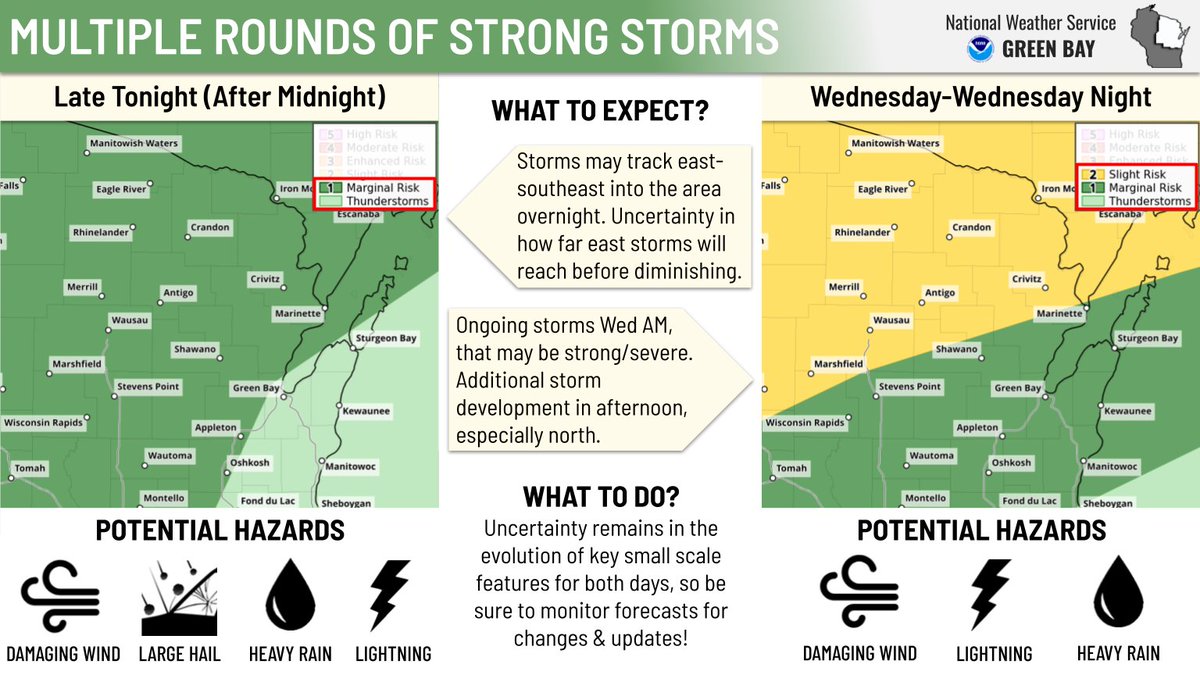 XXXXX engagements  **Related Topics** [green bay](/topic/green-bay) [Post Link](https://x.com/NWSGreenBay/status/1947637340807061765)
[GUEST ACCESS MODE: Data is scrambled or limited to provide examples. Make requests using your API key to unlock full data. Check https://lunarcrush.ai/auth for authentication information.]
 NWS Green Bay @NWSGreenBay on x 17.4K followers
Created: 2025-07-22 12:38:22 UTC
NWS Green Bay @NWSGreenBay on x 17.4K followers
Created: 2025-07-22 12:38:22 UTC
Multiple rounds of storms are possible at times after midnight tonight through Wed night. If strong storms occur, damaging winds, large hail & heavy rain, will be the main hazards. Heat/humidity peaks Wed with heat indices around 100° in areas of central & east-central WI. #wiwx

XXXXX engagements

Related Topics green bay