[GUEST ACCESS MODE: Data is scrambled or limited to provide examples. Make requests using your API key to unlock full data. Check https://lunarcrush.ai/auth for authentication information.]  Nick's Weather Eye [@NickJF75](/creator/twitter/NickJF75) on x 6526 followers Created: 2025-07-17 19:18:54 UTC Friday PM could see isolated #thunderstorms develop over E England, especially E Yorks to N York Moors - due to sea breeze convergence (see TWIG on fax). But the main play will be destabilising nose of higher theta-w plume moving N out of France overnight, as upper trough arrives 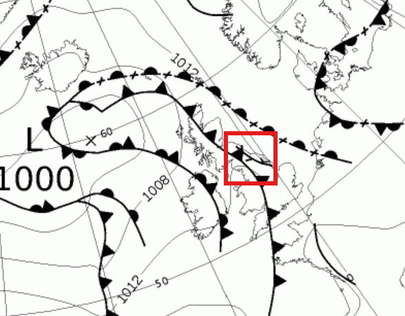 XXXXX engagements  **Related Topics** [france](/topic/france) [convergence](/topic/convergence) [Post Link](https://x.com/NickJF75/status/1945926200469180681)
[GUEST ACCESS MODE: Data is scrambled or limited to provide examples. Make requests using your API key to unlock full data. Check https://lunarcrush.ai/auth for authentication information.]
 Nick's Weather Eye @NickJF75 on x 6526 followers
Created: 2025-07-17 19:18:54 UTC
Nick's Weather Eye @NickJF75 on x 6526 followers
Created: 2025-07-17 19:18:54 UTC
Friday PM could see isolated #thunderstorms develop over E England, especially E Yorks to N York Moors - due to sea breeze convergence (see TWIG on fax). But the main play will be destabilising nose of higher theta-w plume moving N out of France overnight, as upper trough arrives

XXXXX engagements

Related Topics france convergence